Oakley Creek Te Auaunga is the longest urban stream on the Auckland isthmus, extending some 15 kilometres.
You can enjoy a self-guided tour of the Oakley Creek Walkway
>> Oakley Creek Self Guided Tour (pdf)
You can also use Google maps
You might like to view a photographic blog of Oakley Creek by Kennedy Warne http://thecreekabides.tumblr.com/
Oakley Creek is surrounded by 50 hectares of almost continuous green space. It flows from Mt Roskill through Wesley, Owairaka, Mt Albert, Avondale and Waterview before entering the Motu Manawa Marine Reserve in the Waitemata Harbour.
Oakley Creek is unique in that it is accessible to the public for almost its entire length. There is a substantial network of parks and reserves, including War Memorial Park, Walmsley and Underwood Parks, Hendon and Alan Wood Reserves, Harbutt and Phyllis Reserves.
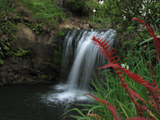
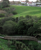
In its lower reaches, it incorporates the beautiful Oakley Creek Walkway, with the only waterfall on the Auckland isthmus.
Oakley Creek is of significant ecological, archaeological, social and recreational value to central Auckland. It is home to a wide variety of flora and fauna, both native and exotic, including heron, weta and eels.
The Creek and its adjoining green space has the potential to become a major part of a ‘coast-to-coast’ green corridor, and is pivotal to the network of green spaces and wildlife links across the wider Auckland region.


